
Daily use — supervisor (GLPI web)
Profiles with the corresponding rights get two new sections in the GLPI administration area.
7.1 Geolocation
Focused on where technicians are. It has four tabs:
- Last Geolocation: the most recent recorded position of each technician on an interactive map — where the team is right now.
- All Geolocation: the full position history, using GLPI's standard search filters. Narrow the results by date range, technician, linked ticket or location, and export them for analysis.
- Waypoints: the same kind of search, but over the raw GPS trail (every point recorded during a trip) rather than the start/end positions — useful to inspect exactly how a route was walked or driven.
- Live Routes: only the routes currently in progress, for real-time follow-up of each technician.
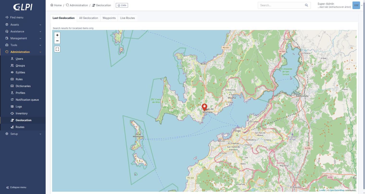
"Last Geolocation" — the most recent position of each technician. Only one technician has reported a position in this environment.
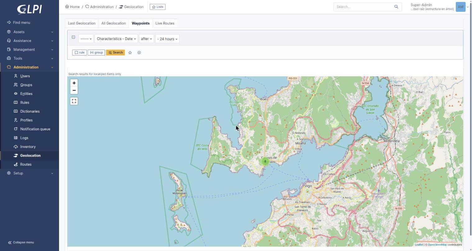
"Waypoints" — searchable GPS trail, filterable by date, user and more. The cluster marker groups nearby points; click it to zoom in.
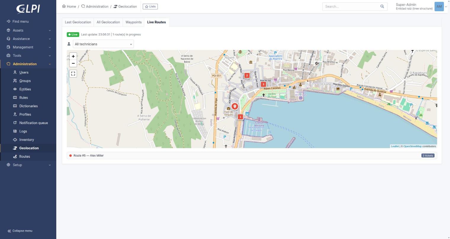
"Live Routes" with a technician actively running a route — the marker shows the current position, numbered pins are the remaining stops.
7.2 Routes
Focused on the detail and history of each journey. The list shows all routes, completed and in progress, with configurable columns: route, technician, creation date, status, number of stops, distance and accumulated time. As with any GLPI list, columns can be customised, sorted and filtered.
Opening a route shows its itinerary on a map with every geolocated point, making it easy to see the order followed, the distance between points and the partial times. It is the quickest way to analyse efficiency or spot a deviation from the plan.
Because a technician may add or skip stops on the road, each route keeps its version history. Reading a route means choosing which version you are looking at — the original plan, or the one that was actually executed.
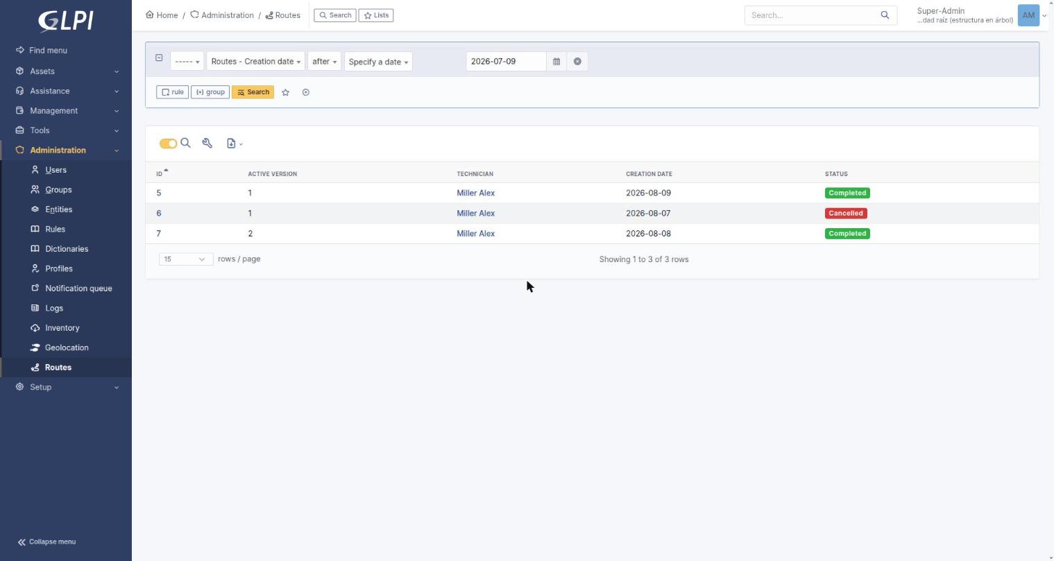
The Routes list — Status added as an extra column via the column picker (⚙), showing routes in different states.
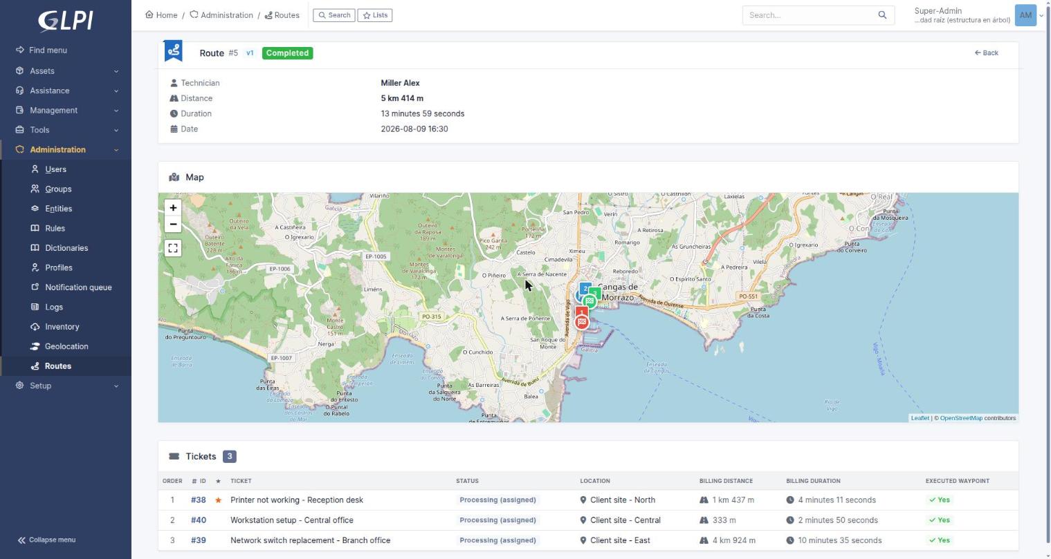
Route detail: distance, duration and date at the top, the itinerary on the map, and the per-ticket breakdown (order, status, location, billing distance/duration) below.
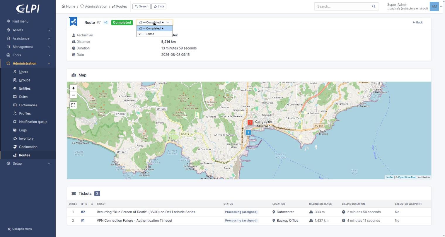
The version selector (top bar) on a route with two versions — "v2 — Completed" and "v1 — Edited".
7.3 Waypoint tab on the ticket
A ticket that has been visited within a route gains a Waypoint tab. It shows one card per trip made to that ticket, comparing the estimated, actual and billable figures described in section 2.4.
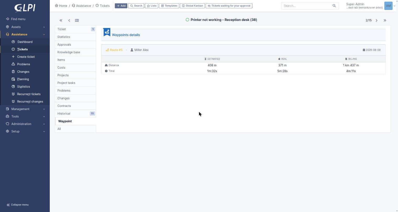
The Waypoint tab on a ticket — Estimated / Real / Billing comparison for one visit.